Real-Time Point Clouds at Post-Processing Quality
The XGRIDS Lixel L2 Pro integrates LiDAR, dual 48MP panoramic cameras, and high-precision IMU with AI-powered SLAM algorithms to deliver ultra-dense, real-time colored point clouds with exceptional accuracy and minimal post-processing. This is professional-grade reality capture that doesn't make you wait.
Unmatched Point Cloud Density: 1 Million Points/m²
The L2 Pro achieves 1 million points per square meter with 1mm point spacing, capturing extraordinary detail for accurate modeling and mapping. Point cloud thickness measures just 5mm, delivering the precision required for confident line drawing and survey-grade documentation.
Why This Matters: Most SLAM scanners sacrifice density for speed. The L2 Pro refuses that compromise, giving you both—without waiting for post-processing to see if you captured what you needed.
Survey-Grade Accuracy Where It Counts
The L2 Pro delivers 2cm relative accuracy and 3cm absolute horizontal and vertical accuracy at distances up to 100 meters.
The Real Comparison: Typical terrestrial laser scanners provide millimeter-level precision at closer ranges (around 10m), but at 100 meters their accuracy degrades to levels comparable to or only slightly better than the L2 Pro's 2-3cm specification—while requiring dramatically slower capture with tripod setups at multiple stations.
With Survey-Grade RTK Module:
Horizontal Accuracy: 0.8cm + 1 ppm
Vertical Accuracy: 1.5cm + 1 ppm
Real-time positioning for demanding survey conditions
The L2 Pro accomplishes survey-grade results while walking, eliminating lengthy station-to-station workflows.
Three Professional Configurations
16-Channel / 120m Range
32-Channel / 120m Range
32-Channel / 300m Range
All models feature 360° × 270° field of view and operate reliably in temperatures down to -20°C (IP54 rated).
Advanced Multi-SLAM Algorithm: Absolute Positioning Anywhere
The L2 Pro's Multi-SLAM algorithm provides seamless absolute positioning even in GNSS-denied environments such as indoors or underground, ensuring continuous, accurate georeferencing without satellite signals.
What Competitors Can't Do: Traditional SLAM scanners lose positioning integrity without GPS and require looped paths for closure. The L2 Pro maintains absolute coordinates throughout your scan, regardless of environment.
Photorealistic Color from Dual 48MP Panoramic Cameras
The dual 48MP panoramic cameras provide rich color data with 190° × 190° field of view, creating photo-quality colored point clouds for realistic 3D visualizations. AI shadow removal algorithms eliminate human shadows in real-time, further reducing post-processing requirements.
LixelStudio: Field-to-Finish Automation
Desktop workstation software designed to automate complex SLAM workflows with one-click processing, converting raw scan data into survey-ready point clouds with centimeter-level precision.
Core Processing:
Automated loop closure and coordinate transformation
Object removal for clean datasets
Fusion of multiple scans with RTK or GCPs
Checkpoint analysis and accuracy reporting
Professional Tools:
Advanced measurement: distance, area, volume
Cross-section generation
Quality control with automatic accuracy reports
Compatible with BIM, CAD, and GIS formats (LAS, E57, RCP)
Industry Applications:
No Cloud Processing Fees—all processing runs on your local workstation.
Lixel Cyber Color (LCC): Dimensionally Accurate Gaussian Splats
Advanced SLAM-based 3D Gaussian Splatting software producing highly efficient, scalable, and measurable 3D models optimized for professional AEC, digital twin, and cultural preservation applications.
Revolutionary Accuracy:
Creates dimensionally accurate Gaussian splats anchored to LiDAR survey data
Unlike photogrammetry-only Gaussian splats, LCC models are measurable with centimeter-level precision
Interactive 3D models with realistic rendering and professional measurement tools
Workflow Advantages:
Models require approximately one-fifth the data size of comparable formats
Faster processing and easier file handling
Seamless fusion of ground and drone scans
HD texture enhancement with DSLR or smartphone images
The Competitive Edge: Standard Gaussian Splatting creates beautiful visualizations but lacks survey accuracy. LCC delivers both photorealism and dimensional precision by leveraging the L2 Pro's high-accuracy LiDAR foundation.
Export & Integration:
Native .lcc format
.ply (Gaussian splatting)
.obj, .glb (meshes)
SDKs: Unity, Unreal Engine, Three.js, Cesium.js, Apple Vision Pro
Direct display in Revit for BIM workflows
Complete System Integration
Operating Time: Extended fieldwork capability with long battery life
Storage: 1TB internal SSD
Control: Touchscreen interface, LixelGO mobile app
Real-Time Features: Live point cloud preview, immediate quality verification
Field of View: 360° × 270°
Operating Temperature: Down to -20°C
Rating: IP54
Available Accessories: Maximum Versatility
RTK Modules:
Standard RTK Module: Centimeter-level real-time positioning accuracy
Survey-Grade RTK Module: 0.8cm + 1ppm horizontal, 1.5cm + 1ppm vertical for demanding survey conditions
Mounting Solutions:
Harness: Comfortable, hands-free operation for extended scanning sessions
Extension Poles: Reach hard-to-reach areas and elevated positions
Vehicle Mount: Corridor and large-area surveys at mobile speeds
Drone Mount: Aerial combined scanning workflows with seamless data fusion
Power & Accessories:
Standard Kit Includes
Lixel L2 Pro handheld scanner
Panoramic cameras (dual 48MP)
Visual positioning cameras
Rechargeable battery
Charger
Type-C USB cable
GCP collection plate
Protective carrying case
LixelStudio software
Quick start documentation
There are also upgraded kits available.
Why Choose the L2 Pro Over Traditional Solutions
Versus Tripod-Based Terrestrial Laser Scanners:
TLS provides millimeter accuracy at 10m, degrading to comparable levels at 100m
TLS requires setup time at each station, dramatically limiting daily coverage
The L2 Pro captures survey-quality data while walking, covering vastly more area per day with comparable accuracy at extended ranges
Versus Competing SLAM Scanners:
Highest point density: 1 million points/m² with 1mm spacing
Real-time post-processed quality data—no waiting to verify capture quality
Superior absolute positioning in GNSS-denied environments
Seamless integration of visual and LiDAR data with AI-enhanced SLAM
Comprehensive software ecosystem from field capture to final deliverable
Real-World Performance: Field to finish efficiency with easy-to-use, powerful point cloud editing and Gaussian splatting visualization capabilities that maximize productivity from capture to deliverable.
Applications
Architecture & Construction: As-built documentation, BIM integration, progress monitoring, quality control
Infrastructure: Highway corridors, railways, bridges, tunnels, large-scale surveys
Professional Surveying: Topographic mapping, engineering measurements, boundary documentation
Cultural Heritage: Historic preservation, archaeological documentation, digital archives
Mining & Underground: Tunnel surveys, stockpile measurement, GNSS-denied mapping
Inspection & Monitoring: Infrastructure condition assessment, deformation analysis
Digital Twins: Facility management, operations planning, virtual walkthroughs
VFX & Gaming: Environment capture, asset creation, virtual production
The XGRIDS Lixel L2 Pro delivers the highest-density point clouds in its class with real-time quality verification, survey-grade accuracy at extended ranges, and a complete software ecosystem that maximizes field-to-finish efficiency. When accuracy, speed, and photorealistic visualization all matter, this is the system that refuses compromise.
View the: L2 Pro Brochure
Sales: (801) 824-6162
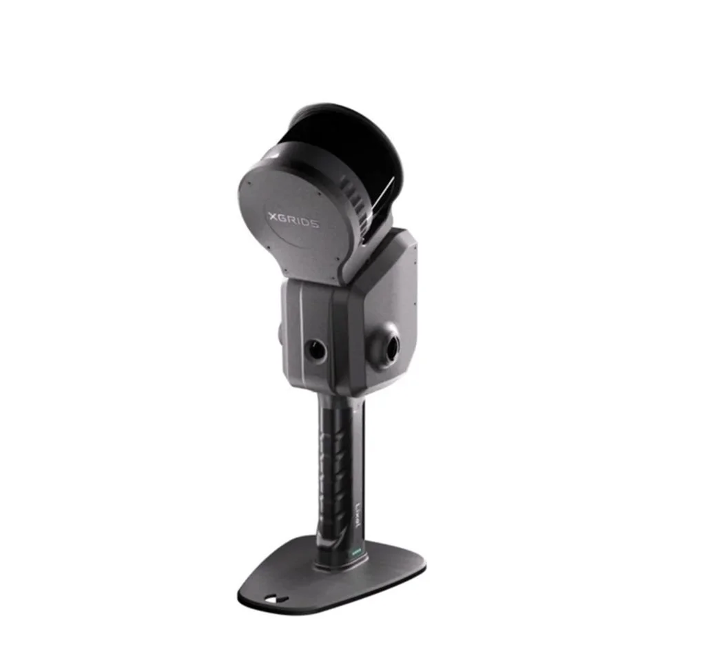 Image 1 of 18
 Image 2 of 18
 Image 3 of 18
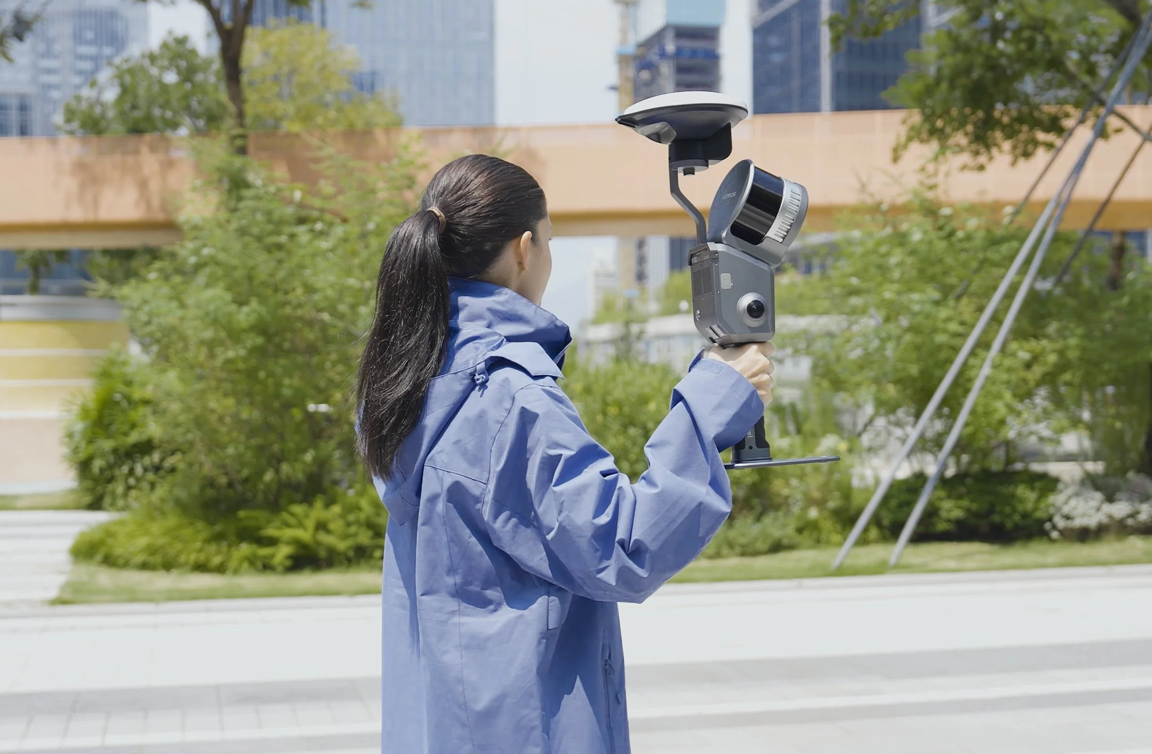 Image 4 of 18
 Image 5 of 18
 Image 6 of 18
 Image 7 of 18
 Image 8 of 18
 Image 9 of 18
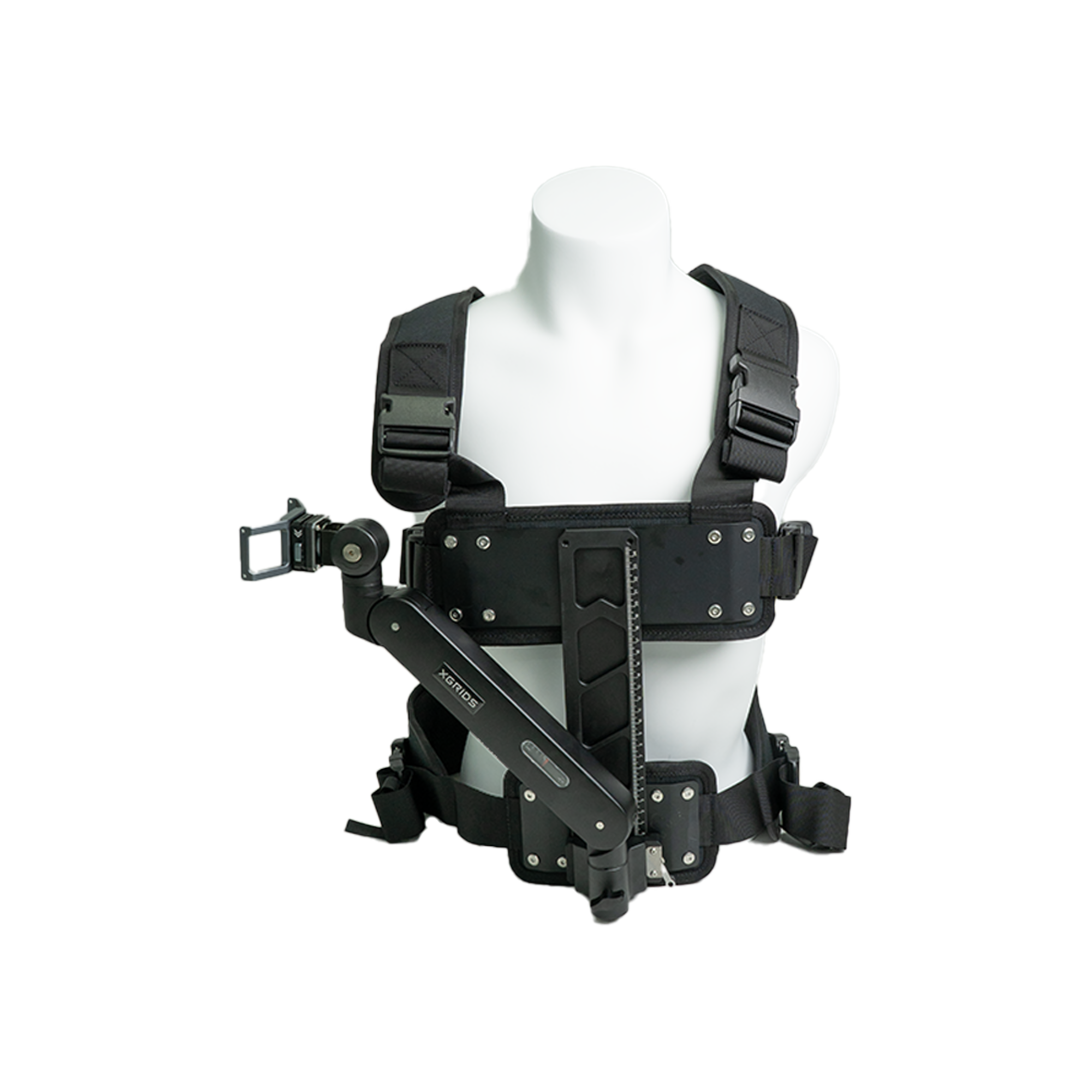 Image 10 of 18
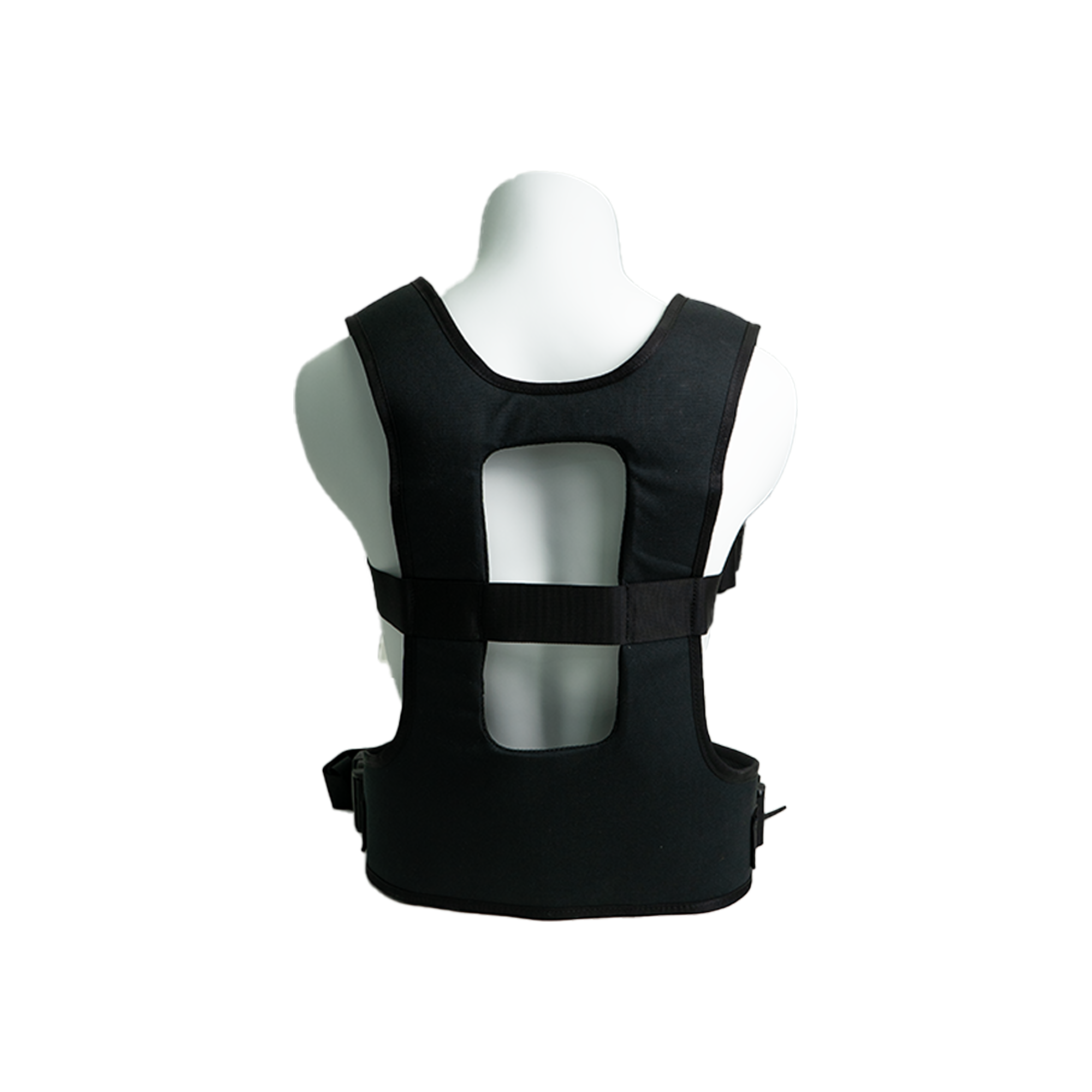 Image 11 of 18
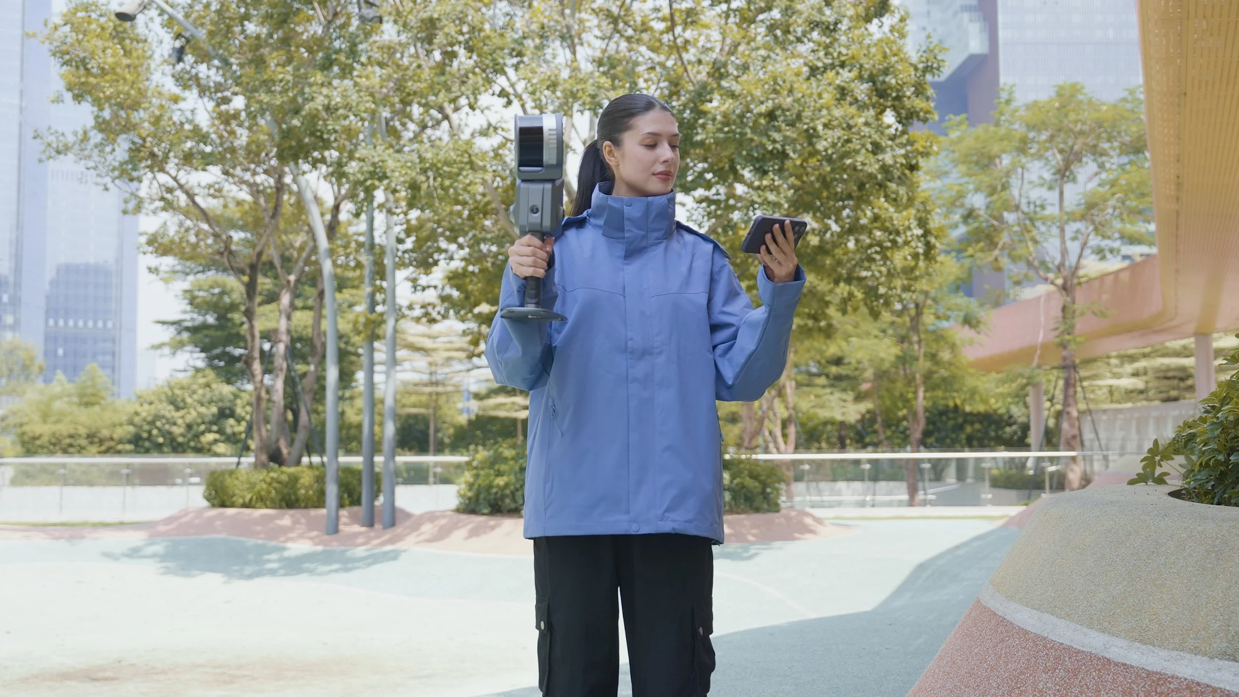 Image 12 of 18
 Image 13 of 18
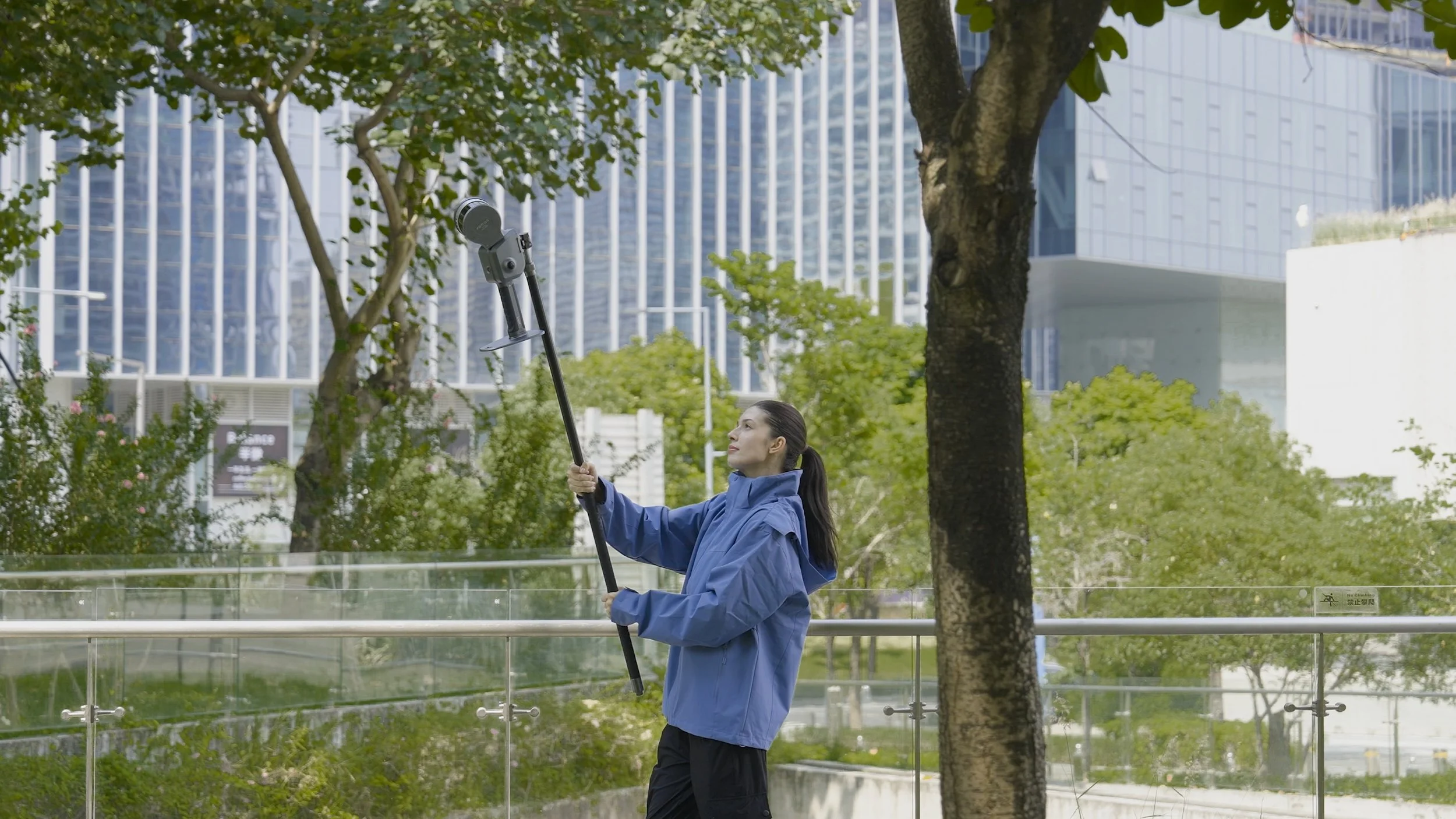 Image 14 of 18
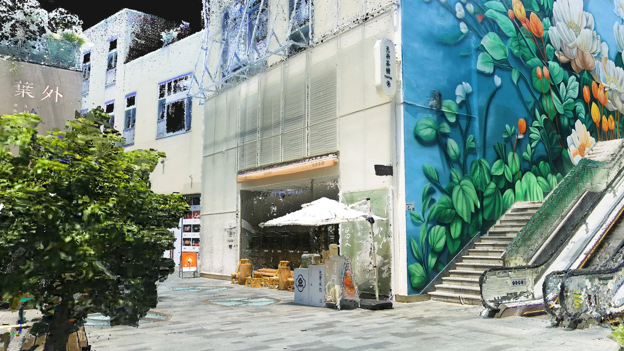 Image 15 of 18
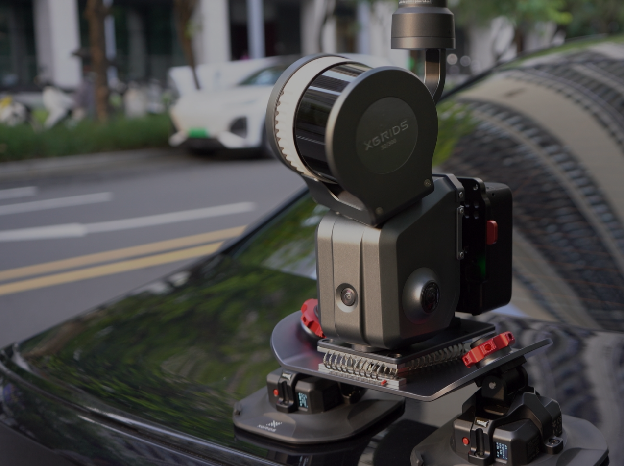 Image 16 of 18
 Image 17 of 18
 Image 18 of 18