Sale Price:
$15,475.00
Original Price:
$17,400.00
DJI Zenmuse L3: The Pinnacle of Long-Range Aerial LiDAR
FREE SHIPPING within the US!
DJI Zenmuse L3: Long-Range LiDAR + Dual 100MP MappingSurvey-Grade Precision. Dual 100MP Imaging. Unrivaled Efficiency.
The DJI Zenmuse L3 is a next-generation aerial LiDAR payload built for professionals. By integrating a high-energy 1535nm LiDAR sensor, dual 100MP RGB mapping cameras, and a high-precision POS system, it transforms the DJI Matrice 400 into a powerhouse for geospatial data.
Key Performance Pillars
Extreme Range: Reach up to 950m @ 10% reflectivity.
Survey-Grade Accuracy: 2–4 cm precision for mapping.
High Efficiency: Cover up to 10 km² per flight / 100 km² per day.
Superior Penetration: 0.25 mrad beam divergence pierces dense canopy for ground points.
Specialized Scanning Modes
Linear Scanning: Best for high-accuracy terrain mapping (consistent distribution).
Star-Shaped Scanning: Best for forests and urban areas (maximum penetration).
Non-Repetitive Scanning: Best for power lines and complex 3D structures.
Technical Specifications
LiDAR Wavelength: 1535 nm
Detection Range: 950 m (100 kHz) / 700 m (350 kHz)
System Accuracy: Vertical: 3 cm / Horizontal: 4 cm (at 120m)
Max Pulse Rate: 2,000,000 pulses per second (2 MHz)
RGB Sensors: Dual 4/3 CMOS, 100 MP
IP Rating: IP54 (Dust and Splash Resistant)
Weight: 1.60 kg
What’s in the Box?
Zenmuse L3 LiDAR payload & Gimbal Connector
Rugged Storage Case & M400 Carrying Case Insert
(2) 1TB CFexpress Type-B Memory Cards & Reader
Lens cleaning cloth & Installation tools
What’s not included

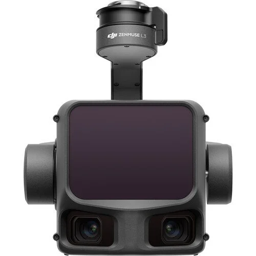 Image 1 of 8
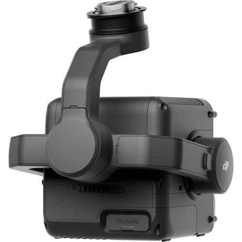 Image 2 of 8
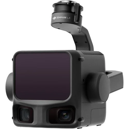 Image 3 of 8
 Image 4 of 8
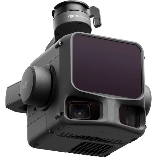 Image 5 of 8
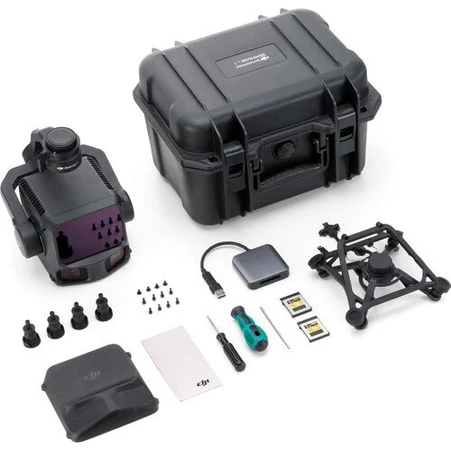 Image 6 of 8
 Image 7 of 8
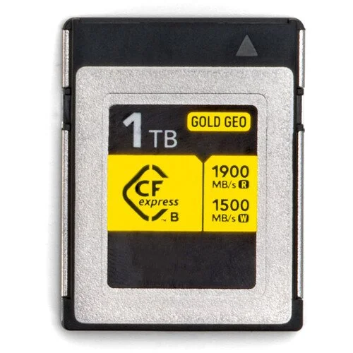 Image 8 of 8