
 Image 1 of 14
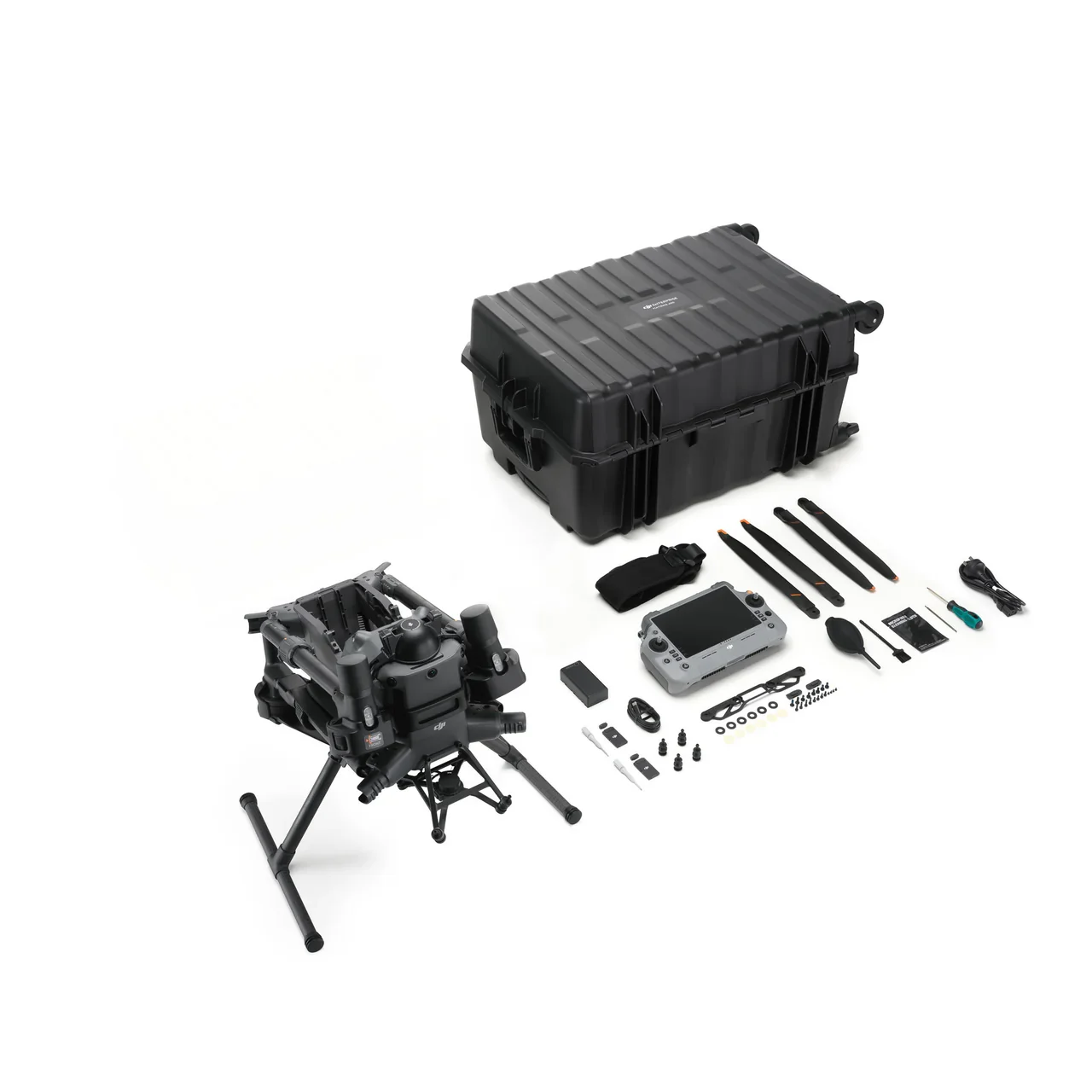 Image 2 of 14
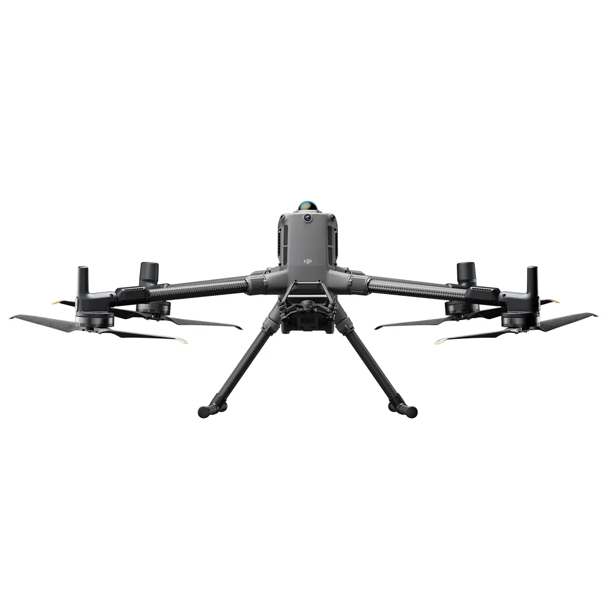 Image 3 of 14
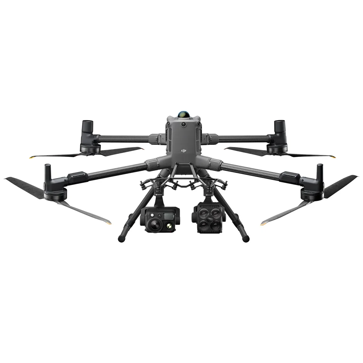 Image 4 of 14
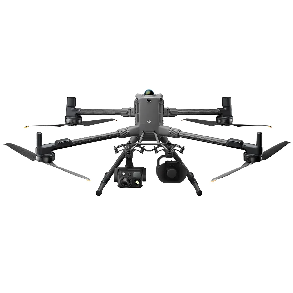 Image 5 of 14
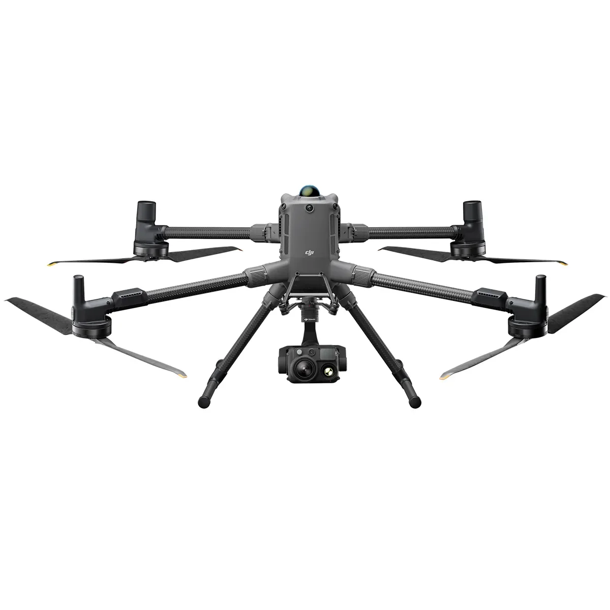 Image 6 of 14
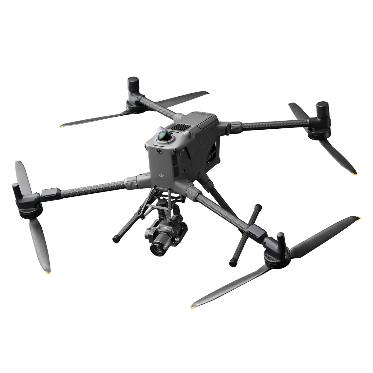 Image 7 of 14
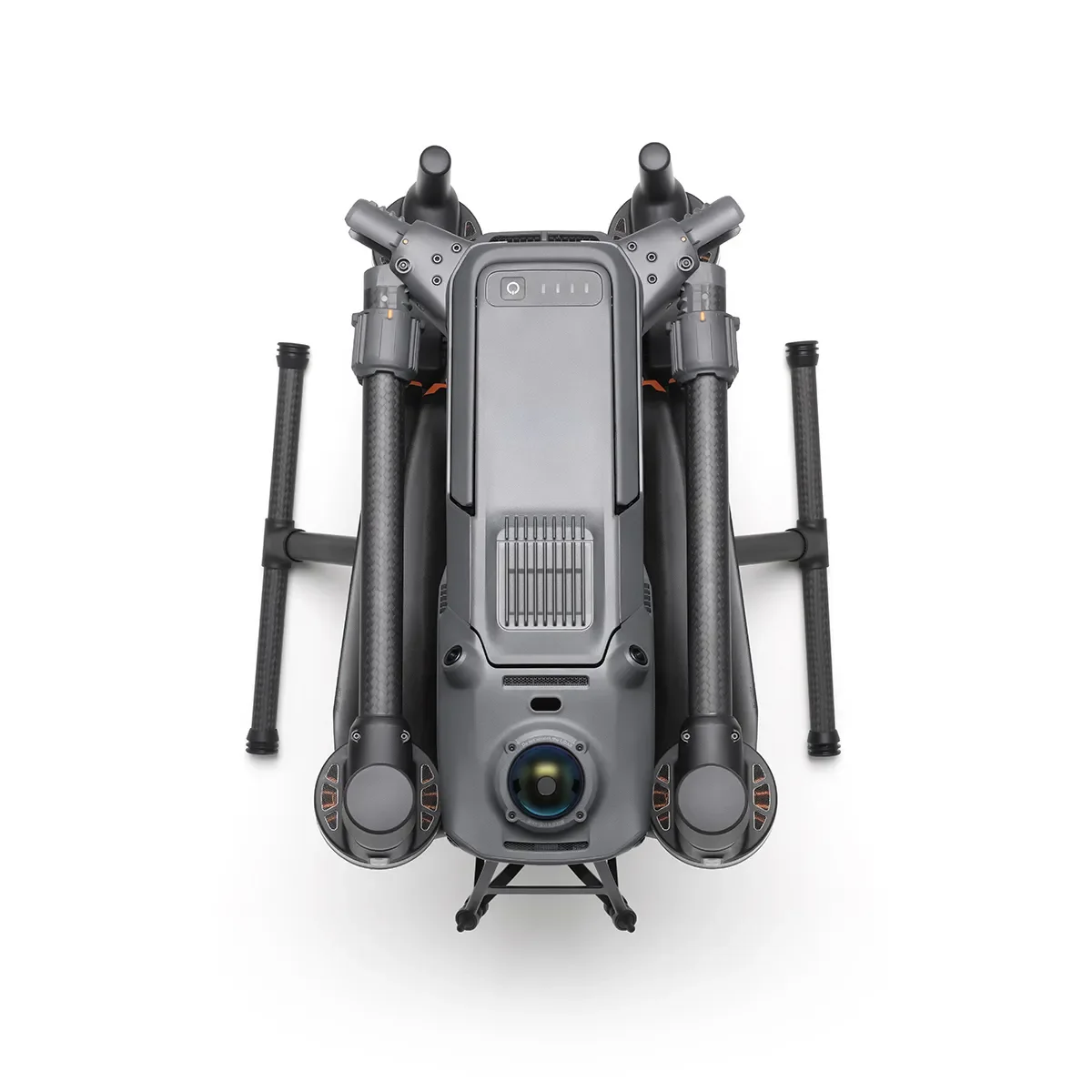 Image 8 of 14
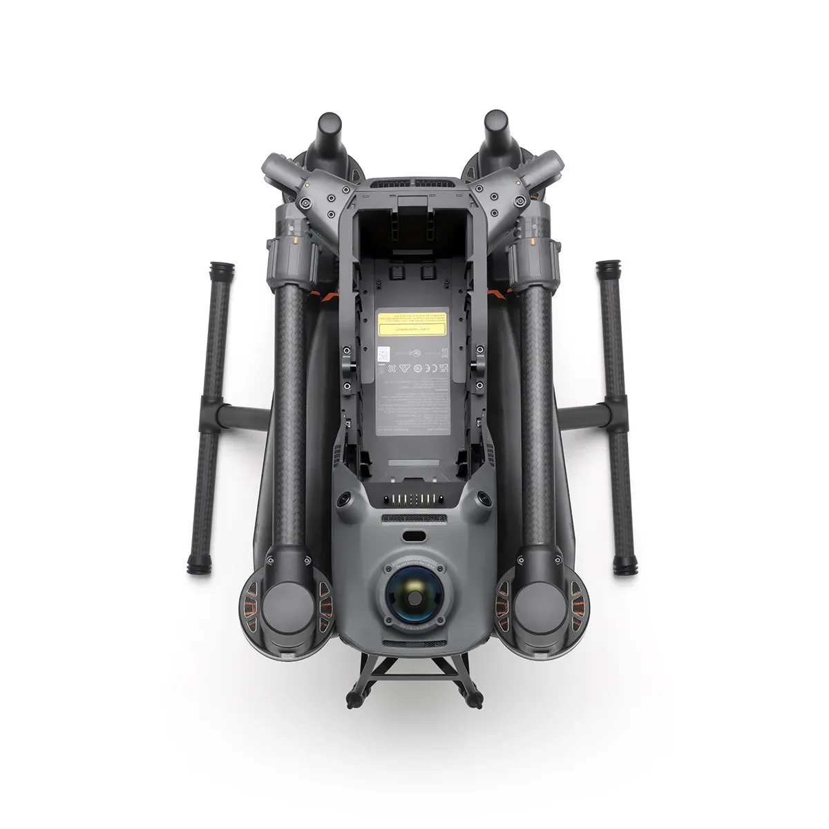 Image 9 of 14
 Image 10 of 14
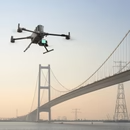 Image 11 of 14
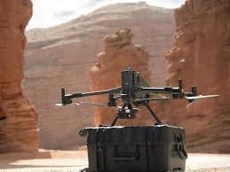 Image 12 of 14
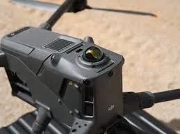 Image 13 of 14
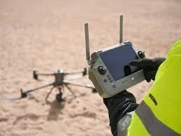 Image 14 of 14
Matrice 400
Long-Endurance Drone Platform With Power-Line-Level Obstacle Sensing
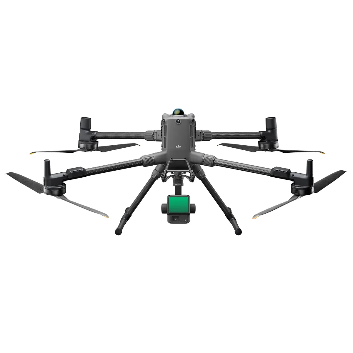
The DJI Matrice 400 is the enterprise flagship drone platform. It delivers a 59-minute flight time, payload capacity up to 13.2 lb, and an integrated rotating LiDAR plus Millimeter Wave radar system that delivers power-line-level obstacle sensing. It supports the O4 Enterprise Enhanced Video Transmission System and Airborne Relay Video Transmission for safer handling and easier operations. With Smart Detection through visible and thermal imaging, AR projection, ship-based takeoff and landing, and advanced automation, the Matrice 400 is engineered for emergency response, power inspections, mapping, and AEC.
Extended Flight Time, High Speed Performance
Flight performance is outstanding. With payload mounted, forward flight time reaches up to 59 minutes and hovering duration reaches up to 53 minutes. This long endurance makes the Matrice 400 a reliable tool for continuous, long-duration operations such as search and rescue, firefighting, and large-area mapping. Flight speed reaches up to 56 mph, and obstacle avoidance functions even at speed against large objects like buildings and mountains.
Multi-Payload, Multi-Scene
The 13.2 lb maximum payload capacity opens the door to a wide range of applications. The aircraft accommodates seamless switching between a single downward gimbal and dual downward gimbals, and includes a third gimbal connector on the underside for additional flexibility. Four external E-Port V2 ports support simultaneous mounting of up to 7 payloads.
Compatible payloads include:
Zenmuse H30 Series. Integrates five major modules (wide-angle camera, zoom camera, infrared thermal camera, laser range finder, NIR auxiliary light) using intelligent algorithms that transcend day and night vision limits.
Zenmuse L2. Frame-based LiDAR with a self-developed high-accuracy IMU and a 4/3 CMOS RGB mapping camera, delivering precise, efficient, and reliable geospatial data.
Zenmuse P1. Full-frame sensor with interchangeable fixed-focus lenses on a 3-axis stabilized gimbal, designed for photogrammetry flight missions.
Zenmuse S1 Spotlight. DJI's first spotlight built for multi-payload drone platforms. Uses LEP technology for high brightness and long illumination distance with multiple lighting modes. Suited to public safety, emergency rescue, inspection, and other nighttime operations.
Zenmuse V1 Speaker. DJI's first loudspeaker for multi-payload drone platforms. High volume, long broadcast distance, multiple broadcast modes. Suited to public safety and emergency rescue.
Manifold 3. Packs 100 TOPS of computing power into a unit weighing approximately 4.2 oz. Mounts on the Matrice 400 to optimize efficiency across operational missions with its onboard processing.
Third-party PSDK payloads through the upgraded E-Port V2.
Built for Challenging Conditions
IP55 protection rating allows reliable operation in heavy dust and rain. Stable performance is maintained across operating temperatures from -4°F to 122°F.
Power-Line-Level Obstacle Sensing
The advanced obstacle sensing system integrates rotating LiDAR, high-precision Millimeter Wave radar, and full-color low-light fisheye vision sensors. Detection capabilities reach unprecedented levels, identifying obstacles as small as high-voltage power lines across mountainous terrain even in darkness. The system penetrates rain and fog to sense surroundings, providing enhanced safety in challenging weather.
Robust Video Transmission: O4 Enterprise Enhanced
The ten-antenna aircraft system paired with a high-gain phased array antenna on the remote controller delivers image transmission up to 25 miles. The Matrice 400 supports the sub-2GHz frequency band and, when equipped with two DJI Cellular Dongle 2 units, automatically switches to the better available carrier network for more stable signal in urban interference environments and remote regions.
Airborne Relay Video Transmission
A built-in video transmission relay module lets one Matrice 400 serve as a relay drone, flying high to provide relay signals for another Matrice 400 operating at greater distance. This significantly extends transmission range and is suited to search and rescue tasks and inspections in mountainous areas.
Aircraft Fusion Positioning
The omnidirectional sensing performance from rotating LiDAR, high-precision Millimeter Wave radar, and full-color low-light fisheye vision sensors gives the Matrice 400 strong positioning capabilities. The aircraft flies stably close to glass facade buildings or wind turbine blades and can return safely from building edges, mountain bases, or bridge sides even when the return point has not been updated.
Full-Color Vision Assist
Four full-color low-light fisheye vision sensors on the aircraft provide Full-Color Vision Assist for safer flight.
Smart Detection
With the Zenmuse H30 Series visible and thermal imaging, the Matrice 400 detects vehicles, vessels, and subjects during search and rescue operations or routine flights. It supports switching to other detection models for expanded application scenarios. It also supports high-resolution grid photos and powerful tracking capabilities.
Smart AR Projection
Power Line AR. During power grid inspection, the obstacle sensing system automatically detects frontal wire obstacles and displays AR lines on the controller screen, making the surrounding environment clear at a glance for safer flight.
Map View AR. When operating during day or night in urban regions, the controller displays building names and landmark labels in real time and marks core roads with prominent lines.
AR Flight Waypoint. Real-time route preview during Return-to-Home, obstacle sensing, and FlyTo operations. During landing, AR Aircraft Shadow can be displayed to help operators confirm the landing location.
Live Annotations. Without modeling, mark points on the controller screen to obtain subject locations, draw lines to measure distances between multiple points, and outline areas to calculate their size. Measurement results sync to DJI FlightHub 2 for team efficiency.
Real-Time Terrain Follow
The Matrice 400 supports Real-Time Terrain Follow flight in any horizontal direction. Available during both manual flight and automated flight routes, it ensures stable relative height to the ground. During large-scale search and rescue, this keeps ground subject scale consistent on the controller screen, reducing zoom adjustments. During mapping missions, it maintains a consistent ground sampling distance for high-precision mapping data.
Takeoff and Landing on Ships
For maritime patrol, wind turbine inspection, and other offshore operations, the Matrice 400 supports takeoff from stationary vessels and landing on moving vessels. By detecting landing-point patterns on the deck, the aircraft achieves safe and precise landings.
Intelligent Flight Modes
Cruise. Pilot the drone in a specific direction without continuous stick input, easing long-distance flights and linear inspections.
FlyTo. In emergencies or disasters, the drone automatically adjusts flight path and speed based on the surrounding environment to reach a designated location without manual adjustment.
Smart Track. Precise subject positioning with automatic zoom adjustments and easy switching between subjects. Reacquires a subject automatically even if briefly obscured.
POI. Continuous observation and 3D modeling of buildings while orbiting a designated area. Greatly enhances efficiency of fixed-point observation and modeling tasks.
Easier Automated Operations
Power Line Follow with Zenmuse L2. Equipped with the L2 LiDAR system, the Matrice 400 performs automated power transmission and distribution line following flights. Rotating LiDAR detects obstacles in real time and the aircraft automatically bypasses crossing lines.
Slope Route and Geometric Route. Plan and execute slope and geometric routes via DJI Pilot 2 or DJI FlightHub 2. Whether conducting detailed surveys of building facades, slopes, or other inclined surfaces, or collecting mapping data of individual buildings or structures, the Matrice 400 plans routes quickly to acquire high-precision data.
Comprehensive Accessory Upgrades
DJI RC Plus 2 Enterprise Enhanced. New high-brightness screen visible in direct sunlight. IP54 protection rating. Operates from -4°F to 122°F. Equipped with O4 Enterprise Enhanced Video Transmission and a built-in high-gain antenna array. Supports the sub-2GHz module and 4G hybrid transmission for stable, smooth video feeds in urban high-rise and mountainous environments.
DJI Cellular Dongle 2. Provides 4G network video transmission that works alongside the O4 Enterprise Enhanced Video Transmission System for safe flight in complex environments. Provides mobile network connectivity for the remote controller.
TB100 Battery. High-performance, high-energy cells. Up to 400 charge cycles, reducing cost per flight. Enhanced heat dissipation and a self-heating system for improved reliability.
TB100C Tethered Battery. Compatible with third-party tethered lighting and communication products for long-duration aerial lighting and communication base station functions via cable. Reserved ports support third-party development of automated recharging station products such as drone docks.
BS100 Intelligent Battery Station. One-stop solution for battery charging, storage, and transport. Charges up to three TB100 batteries and two WB37 batteries sequentially. TB100 fast charge in 45 minutes. In Silent Mode, noise levels are as low as 36 dB.
D-RTK 3 Multifunctional Station. Serves as a base station to provide centimeter-level positioning for multiple drones simultaneously. The Rover Station Mode, combined with the DJI Enterprise app and DJI Terra, provides a comprehensive solution for high-precision aerial surveying applications.
Software Designed for Industries
DJI FlightHub 2. For the Matrice 400, FlightHub 2 has been upgraded for cloud-based remote control: aircraft attitude, official payload control, remote takeoff and landing, and Live Flight Controls. Supports slope routes, geometric routes, and other advanced route types. During multi-drone operations, operators remotely synchronize and display multiple livestreams across screens for efficient air-ground integrated operation. (Customers who purchase the Matrice 400 and bind it to FlightHub 2 upon activation receive allocated live streaming minutes, map imagery quotas, and cloud storage space.)
DJI Terra. 3D model reconstruction software with photogrammetry as its core. Supports accurate, efficient 2D and 3D reconstruction from visible-light data, and point cloud data reconstruction and processing with the DJI Zenmuse L2. Built to pair with the Matrice 400 and its payloads for vertical applications including land surveying and mapping, power line inspection, emergency response, construction, and forestry.
DJI Modify. Intelligent 3D mesh and point cloud model editing. Paired with the Matrice 400 and DJI Terra, creates an integrated solution covering aerial surveying, modeling, model repair, and sharing.
Open Developer Ecosystem
Intelligent Algorithm Developer. Model training tools and a third-party developer certification process to access onboard computing capability, expanding new application fields for drones.
PSDK. The upgraded E-Port V2 supports USB 3.0 high-speed payload communication and delivers up to 120 watts of power per port. The E4 port can be expanded into four payload ports via the E-Port Hub plate.
MSDK. Mobile SDK 5 simplifies the development of apps to control the Matrice 400. Fully open-source, production-level code samples adapted from DJI Pilot 2 core modules.
Cloud API. With DJI Pilot 2's built-in Cloud API (MQTT-based protocol), connect the Matrice 400 directly to third-party cloud platforms. Access aircraft hardware, video livestream, and photo data without developing a separate app.
Open Data Access. Developers can leverage payload, LiDAR, Millimeter Wave radar, and vision sensor data interfaces to build innovative applications and expand the DJI ecosystem.
User Data Security
Media data encryption. Local Data Mode. One-Tap Clear Logs. AES-256 video transmission encryption. Cloud API.
Application Scenarios
Public Safety. Power Line Inspection. Geographic Information. Oil and Natural Gas. Renewable Energy. Water Conservation. Maritime. Roads and Bridges.
Long-Endurance Drone Platform With Power-Line-Level Obstacle Sensing
The DJI Matrice 400 is the enterprise flagship drone platform. It delivers a 59-minute flight time, payload capacity up to 13.2 lb, and an integrated rotating LiDAR plus Millimeter Wave radar system that delivers power-line-level obstacle sensing. It supports the O4 Enterprise Enhanced Video Transmission System and Airborne Relay Video Transmission for safer handling and easier operations. With Smart Detection through visible and thermal imaging, AR projection, ship-based takeoff and landing, and advanced automation, the Matrice 400 is engineered for emergency response, power inspections, mapping, and AEC.
Extended Flight Time, High Speed Performance
Flight performance is outstanding. With payload mounted, forward flight time reaches up to 59 minutes and hovering duration reaches up to 53 minutes. This long endurance makes the Matrice 400 a reliable tool for continuous, long-duration operations such as search and rescue, firefighting, and large-area mapping. Flight speed reaches up to 56 mph, and obstacle avoidance functions even at speed against large objects like buildings and mountains.
Multi-Payload, Multi-Scene
The 13.2 lb maximum payload capacity opens the door to a wide range of applications. The aircraft accommodates seamless switching between a single downward gimbal and dual downward gimbals, and includes a third gimbal connector on the underside for additional flexibility. Four external E-Port V2 ports support simultaneous mounting of up to 7 payloads.
Compatible payloads include:
Zenmuse H30 Series. Integrates five major modules (wide-angle camera, zoom camera, infrared thermal camera, laser range finder, NIR auxiliary light) using intelligent algorithms that transcend day and night vision limits.
Zenmuse L2. Frame-based LiDAR with a self-developed high-accuracy IMU and a 4/3 CMOS RGB mapping camera, delivering precise, efficient, and reliable geospatial data.
Zenmuse P1. Full-frame sensor with interchangeable fixed-focus lenses on a 3-axis stabilized gimbal, designed for photogrammetry flight missions.
Zenmuse S1 Spotlight. DJI's first spotlight built for multi-payload drone platforms. Uses LEP technology for high brightness and long illumination distance with multiple lighting modes. Suited to public safety, emergency rescue, inspection, and other nighttime operations.
Zenmuse V1 Speaker. DJI's first loudspeaker for multi-payload drone platforms. High volume, long broadcast distance, multiple broadcast modes. Suited to public safety and emergency rescue.
Manifold 3. Packs 100 TOPS of computing power into a unit weighing approximately 4.2 oz. Mounts on the Matrice 400 to optimize efficiency across operational missions with its onboard processing.
Third-party PSDK payloads through the upgraded E-Port V2.
Built for Challenging Conditions
IP55 protection rating allows reliable operation in heavy dust and rain. Stable performance is maintained across operating temperatures from -4°F to 122°F.
Power-Line-Level Obstacle Sensing
The advanced obstacle sensing system integrates rotating LiDAR, high-precision Millimeter Wave radar, and full-color low-light fisheye vision sensors. Detection capabilities reach unprecedented levels, identifying obstacles as small as high-voltage power lines across mountainous terrain even in darkness. The system penetrates rain and fog to sense surroundings, providing enhanced safety in challenging weather.
Robust Video Transmission: O4 Enterprise Enhanced
The ten-antenna aircraft system paired with a high-gain phased array antenna on the remote controller delivers image transmission up to 25 miles. The Matrice 400 supports the sub-2GHz frequency band and, when equipped with two DJI Cellular Dongle 2 units, automatically switches to the better available carrier network for more stable signal in urban interference environments and remote regions.
Airborne Relay Video Transmission
A built-in video transmission relay module lets one Matrice 400 serve as a relay drone, flying high to provide relay signals for another Matrice 400 operating at greater distance. This significantly extends transmission range and is suited to search and rescue tasks and inspections in mountainous areas.
Aircraft Fusion Positioning
The omnidirectional sensing performance from rotating LiDAR, high-precision Millimeter Wave radar, and full-color low-light fisheye vision sensors gives the Matrice 400 strong positioning capabilities. The aircraft flies stably close to glass facade buildings or wind turbine blades and can return safely from building edges, mountain bases, or bridge sides even when the return point has not been updated.
Full-Color Vision Assist
Four full-color low-light fisheye vision sensors on the aircraft provide Full-Color Vision Assist for safer flight.
Smart Detection
With the Zenmuse H30 Series visible and thermal imaging, the Matrice 400 detects vehicles, vessels, and subjects during search and rescue operations or routine flights. It supports switching to other detection models for expanded application scenarios. It also supports high-resolution grid photos and powerful tracking capabilities.
Smart AR Projection
Power Line AR. During power grid inspection, the obstacle sensing system automatically detects frontal wire obstacles and displays AR lines on the controller screen, making the surrounding environment clear at a glance for safer flight.
Map View AR. When operating during day or night in urban regions, the controller displays building names and landmark labels in real time and marks core roads with prominent lines.
AR Flight Waypoint. Real-time route preview during Return-to-Home, obstacle sensing, and FlyTo operations. During landing, AR Aircraft Shadow can be displayed to help operators confirm the landing location.
Live Annotations. Without modeling, mark points on the controller screen to obtain subject locations, draw lines to measure distances between multiple points, and outline areas to calculate their size. Measurement results sync to DJI FlightHub 2 for team efficiency.
Real-Time Terrain Follow
The Matrice 400 supports Real-Time Terrain Follow flight in any horizontal direction. Available during both manual flight and automated flight routes, it ensures stable relative height to the ground. During large-scale search and rescue, this keeps ground subject scale consistent on the controller screen, reducing zoom adjustments. During mapping missions, it maintains a consistent ground sampling distance for high-precision mapping data.
Takeoff and Landing on Ships
For maritime patrol, wind turbine inspection, and other offshore operations, the Matrice 400 supports takeoff from stationary vessels and landing on moving vessels. By detecting landing-point patterns on the deck, the aircraft achieves safe and precise landings.
Intelligent Flight Modes
Cruise. Pilot the drone in a specific direction without continuous stick input, easing long-distance flights and linear inspections.
FlyTo. In emergencies or disasters, the drone automatically adjusts flight path and speed based on the surrounding environment to reach a designated location without manual adjustment.
Smart Track. Precise subject positioning with automatic zoom adjustments and easy switching between subjects. Reacquires a subject automatically even if briefly obscured.
POI. Continuous observation and 3D modeling of buildings while orbiting a designated area. Greatly enhances efficiency of fixed-point observation and modeling tasks.
Easier Automated Operations
Power Line Follow with Zenmuse L2. Equipped with the L2 LiDAR system, the Matrice 400 performs automated power transmission and distribution line following flights. Rotating LiDAR detects obstacles in real time and the aircraft automatically bypasses crossing lines.
Slope Route and Geometric Route. Plan and execute slope and geometric routes via DJI Pilot 2 or DJI FlightHub 2. Whether conducting detailed surveys of building facades, slopes, or other inclined surfaces, or collecting mapping data of individual buildings or structures, the Matrice 400 plans routes quickly to acquire high-precision data.
Comprehensive Accessory Upgrades
DJI RC Plus 2 Enterprise Enhanced. New high-brightness screen visible in direct sunlight. IP54 protection rating. Operates from -4°F to 122°F. Equipped with O4 Enterprise Enhanced Video Transmission and a built-in high-gain antenna array. Supports the sub-2GHz module and 4G hybrid transmission for stable, smooth video feeds in urban high-rise and mountainous environments.
DJI Cellular Dongle 2. Provides 4G network video transmission that works alongside the O4 Enterprise Enhanced Video Transmission System for safe flight in complex environments. Provides mobile network connectivity for the remote controller.
TB100 Battery. High-performance, high-energy cells. Up to 400 charge cycles, reducing cost per flight. Enhanced heat dissipation and a self-heating system for improved reliability.
TB100C Tethered Battery. Compatible with third-party tethered lighting and communication products for long-duration aerial lighting and communication base station functions via cable. Reserved ports support third-party development of automated recharging station products such as drone docks.
BS100 Intelligent Battery Station. One-stop solution for battery charging, storage, and transport. Charges up to three TB100 batteries and two WB37 batteries sequentially. TB100 fast charge in 45 minutes. In Silent Mode, noise levels are as low as 36 dB.
D-RTK 3 Multifunctional Station. Serves as a base station to provide centimeter-level positioning for multiple drones simultaneously. The Rover Station Mode, combined with the DJI Enterprise app and DJI Terra, provides a comprehensive solution for high-precision aerial surveying applications.
Software Designed for Industries
DJI FlightHub 2. For the Matrice 400, FlightHub 2 has been upgraded for cloud-based remote control: aircraft attitude, official payload control, remote takeoff and landing, and Live Flight Controls. Supports slope routes, geometric routes, and other advanced route types. During multi-drone operations, operators remotely synchronize and display multiple livestreams across screens for efficient air-ground integrated operation. (Customers who purchase the Matrice 400 and bind it to FlightHub 2 upon activation receive allocated live streaming minutes, map imagery quotas, and cloud storage space.)
DJI Terra. 3D model reconstruction software with photogrammetry as its core. Supports accurate, efficient 2D and 3D reconstruction from visible-light data, and point cloud data reconstruction and processing with the DJI Zenmuse L2. Built to pair with the Matrice 400 and its payloads for vertical applications including land surveying and mapping, power line inspection, emergency response, construction, and forestry.
DJI Modify. Intelligent 3D mesh and point cloud model editing. Paired with the Matrice 400 and DJI Terra, creates an integrated solution covering aerial surveying, modeling, model repair, and sharing.
Open Developer Ecosystem
Intelligent Algorithm Developer. Model training tools and a third-party developer certification process to access onboard computing capability, expanding new application fields for drones.
PSDK. The upgraded E-Port V2 supports USB 3.0 high-speed payload communication and delivers up to 120 watts of power per port. The E4 port can be expanded into four payload ports via the E-Port Hub plate.
MSDK. Mobile SDK 5 simplifies the development of apps to control the Matrice 400. Fully open-source, production-level code samples adapted from DJI Pilot 2 core modules.
Cloud API. With DJI Pilot 2's built-in Cloud API (MQTT-based protocol), connect the Matrice 400 directly to third-party cloud platforms. Access aircraft hardware, video livestream, and photo data without developing a separate app.
Open Data Access. Developers can leverage payload, LiDAR, Millimeter Wave radar, and vision sensor data interfaces to build innovative applications and expand the DJI ecosystem.
User Data Security
Media data encryption. Local Data Mode. One-Tap Clear Logs. AES-256 video transmission encryption. Cloud API.
Application Scenarios
Public Safety. Power Line Inspection. Geographic Information. Oil and Natural Gas. Renewable Energy. Water Conservation. Maritime. Roads and Bridges.