Flagship Intelligent Multi-Sensor Compact Drone
The Age of Intelligent Flight.
The DJI Matrice 4T is part of the new compact and intelligent multi-sensor flagship drone series for enterprise industries. Equipped with advanced features including smart detection, measurement with laser range finder, and infrared thermal imaging. Flight operations are safer, more reliable, and powered by AI, with significantly enhanced sensing capabilities. The Matrice 4T is suited to a wide range of industries including electricity, emergency response, public safety, and forestry conservation.
Camera System
Wide-Angle Camera. 1/1.3 inch CMOS, 48 MP effective pixels, f/1.7, 24 mm format equivalent.
Medium Tele Camera. 1/1.3 inch CMOS, 48 MP effective pixels, f/2.8, 70 mm format equivalent.
Tele Camera. 1/1.5 inch CMOS, 48 MP effective pixels, f/2.8, 168 mm format equivalent.
Laser Range Finder. Measurement range 5,906 ft (1 Hz). Oblique incidence range (1:5 oblique distance) 1,969 ft (1 Hz). Blind zone 3.3 ft. Range accuracy 0.2 + 0.0015 × D (m).
Infrared Thermal Camera. 640 × 512 resolution. f/1.0. 53 mm equivalent focal length. Uncooled VOx microbolometer. Supports High-Res Mode.
NIR Auxiliary Light. 6° field of view. Illumination distance up to 328 ft.
Intelligent Operations With AI
The built-in AI model detects vehicles, vessels, and subjects during search and rescue or routine flights. It supports switching to other models, expanding AI application scenarios. The aircraft also supports high-resolution grid photos and powerful tracking capabilities.
Laser Range Finder, Precise Measurement
Real-time precise measurement through pin point, line drawing, and area calculation. Mark target locations for inspection or calculate the area of a wildfire. Information shares through DJI Pilot QR code or FlightHub 2.
Observation Range Recording
DJI Pilot 2 highlights the center position of the camera frame and ground area observed. The surveyed area displays on the map, particularly useful for patrols and rescue operations in mountainous terrain.
Efficient Flight, Intelligent Operations
Cruise. Cruise control without continuous stick input.
FlyTo. Automatic flight path and speed adjustment based on the surrounding environment.
Smart Track. Precise subject positioning and automatic zoom adjustments. Reacquires a subject automatically.
POI. Continuous observation and 3D modeling while orbiting.
Excels in Low-Light Environments
Night Scene Mode. Full-color night vision with three modes and two levels of enhanced noise reduction. IR Cut Filter and NIR auxiliary light.
Smart Low-Light Photo. Larger apertures and intelligent low-light capabilities for dusk and nighttime.
Infrared Illumination. New NIR illumination hardware enables lighting distances up to 328 ft. Suited to applications like wildlife protection.
Thermal Imaging. Infrared High-Res Mode with image resolutions up to 1280 × 1024. Ultra-High Resolution reveals small temperature details. Each device undergoes temperature accuracy calibration with an onboard temperature sensor for real-time temperature measurement.
Low-Light Fisheye Omnidirectional Sensing. Six high-definition low-light fisheye lenses significantly enhance visual low-light positioning and obstacle avoidance. Allows automatic obstacle avoidance, intelligent rerouting, and safe return in urban low-light environments.
Crystal Clear Vision: Unveil the Details
Enhanced Medium Telephoto. Detects screws and cracks from a distance of 33 ft. Reads instrument data at substations clearly.
Tele Camera Detail. 48 MP resolution captures details from signs up to 820 ft away. The Matrice 4T includes an IR-Cut Filter for 24/7 operations.
Foreground Stabilization. Telephoto stabilization keeps foreground subjects stable and clear at 10x zoom or higher.
Electronic Dehazing. Three modes (Low, Medium, High) for smog and atmospheric humidity.
Safe Flight, Worry-Free Operation
Fusion Positioning, Safe Return-to-Home. Integrated DJI RTK module with extended L5 frequency band, GNSS plus Vision Fusion Positioning. Return-to-Home point updates through visual positioning. Rapid takeoff within 15 seconds. Return-to-Home succeeds even without GNSS signal.
Intelligent Guidance. When the DJI RC Plus 2 Enterprise controller connects to the internet, it loads terrain elevation maps for automatic path planning. The drone has a 5-directional vision assist plus downward vision system.
Achieve New Heights in Video Transmission
The O4 Enterprise video transmission system. The 8-antenna system and high-gain controller antenna deliver transmission range up to 15.5 mi. Download bandwidth of 20 MB/s, more than double the Mavic 3 Enterprise Series bitrate. Supports an optional DJI Cellular Dongle 2 for 4G hybrid transmission.
Accessory Upgrades
Gimbal-Following Spotlight (DJI AL1). Up to 328 ft illumination. Always-On and Strobe modes. Gimbal-following.
Real-Time Voice Speaker (DJI AS1). Broadcast range up to 984 ft. Volume up to 114 dB at 3.3 ft. Recorded messages, media imports, text-to-speech, real-time broadcasting, echo suppression.
Integrated Broadcasting and Lighting. Spotlight and speaker function independently or together.
High-Precision D-RTK 3 Multifunctional Station. Base station, relay station, and Rover Station modes.
DJI RC Plus 2 Enterprise. High-brightness screen, IP54, -4°F to 122°F operation, high-gain antenna array, O4 Enterprise plus 4G hybrid transmission.
DJI Cellular Dongle 2. 4G network video transmission.
DJI Power 1000. 200W fast charging for Matrice 4 Series batteries (full charge in 48 minutes). 2200W AC output. Pairs with DJI Power 1kW car charger.
Software Designed for Industries
DJI Pilot 2. Customizable intelligent function toolbar. Virtual space models and route preview. FlightHub 2 connection.
DJI FlightHub 2. Remote control with route planning including remote takeoff and landing, geometric routes, and slope routes. Live Flight Controls. Multi-drone livestream synchronization.
DJI Terra. 2D, 3D, and point cloud model data for geographic information, emergency response, and construction planning.
DJI Modify. Intelligent 3D mesh and point cloud model editing.
DTAT 3.0. Thermal analysis tool. After thermal imaging operations with the Matrice 4T, mark, analyze, and process images to detect abnormal temperature points.
Open Developer Ecosystem
AI Developer. Model training tools and third-party developer certification.
PSDK. Port and E-Port Lite encryption authentication.
MSDK. Mobile SDK 5 fully open source with production code samples.
Cloud API. Connect to third-party cloud platforms.
DJI Terra API. Integrate mapping into custom platforms.
User Data Security
Local Data Mode. One-Tap Clear All Device Data. AES-256 Video Transmission Encryption. Cloud API.
Application Scenarios
Public Safety. Power Line Inspection. Geographic Information. Oil and Gas. Renewable Energy. Maritime. Water Conservation. Roads and Bridges.
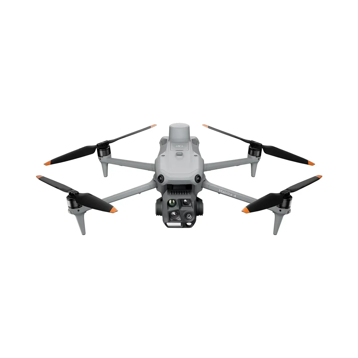 Image 1 of 8
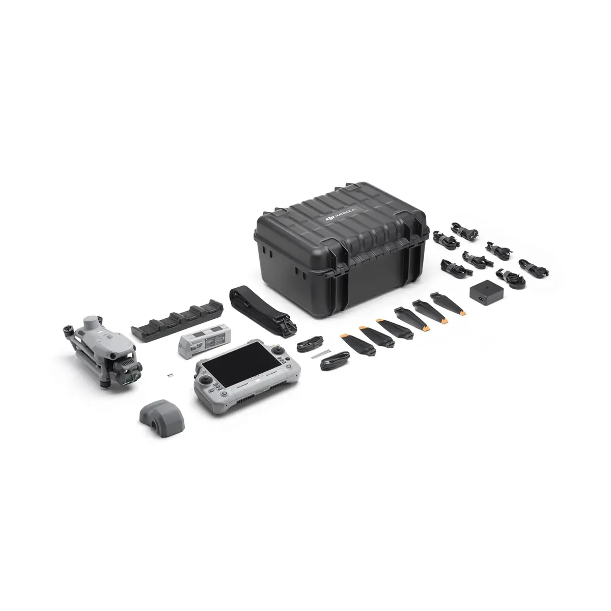 Image 2 of 8
 Image 3 of 8
 Image 4 of 8
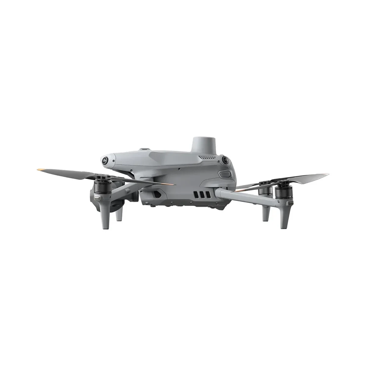 Image 5 of 8
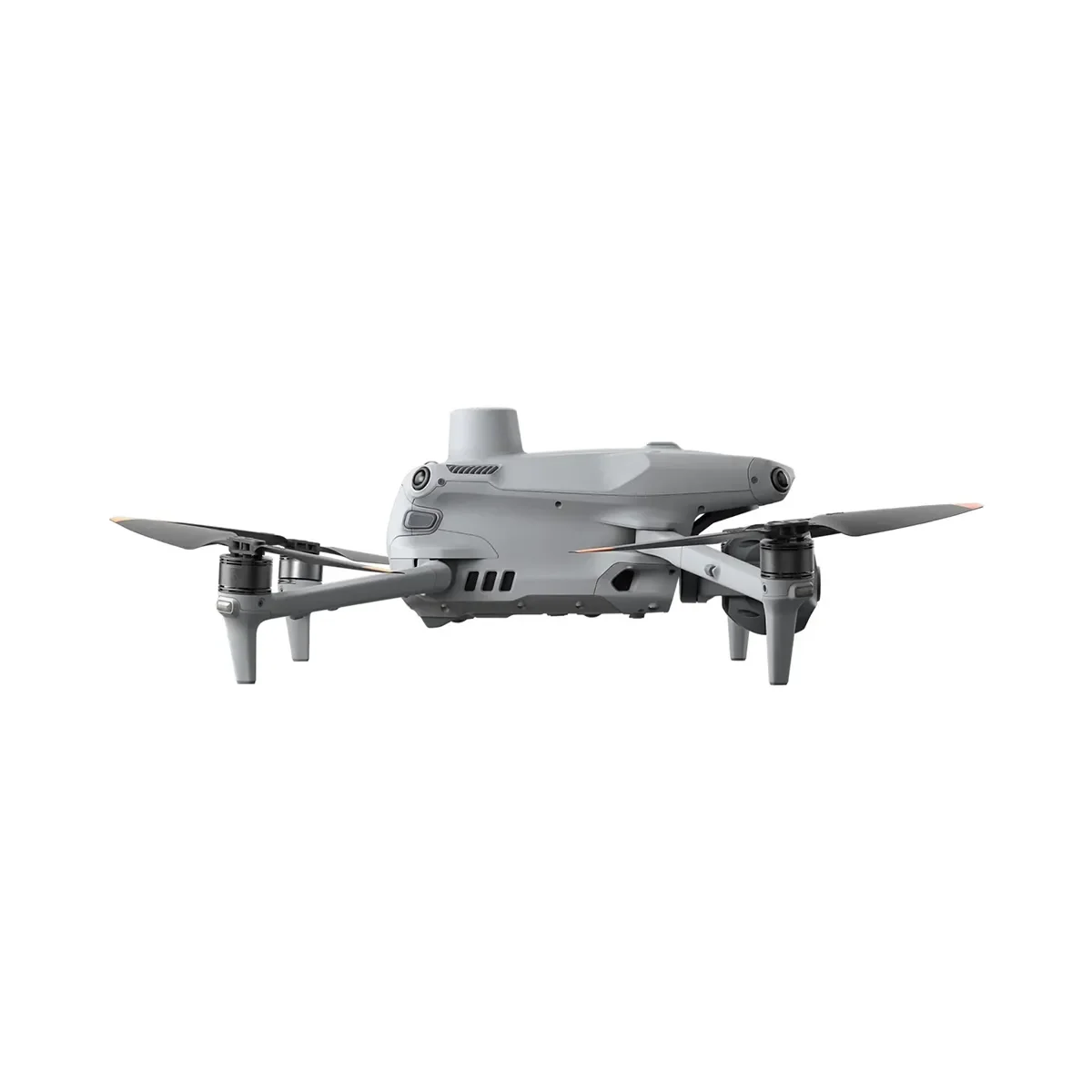 Image 6 of 8
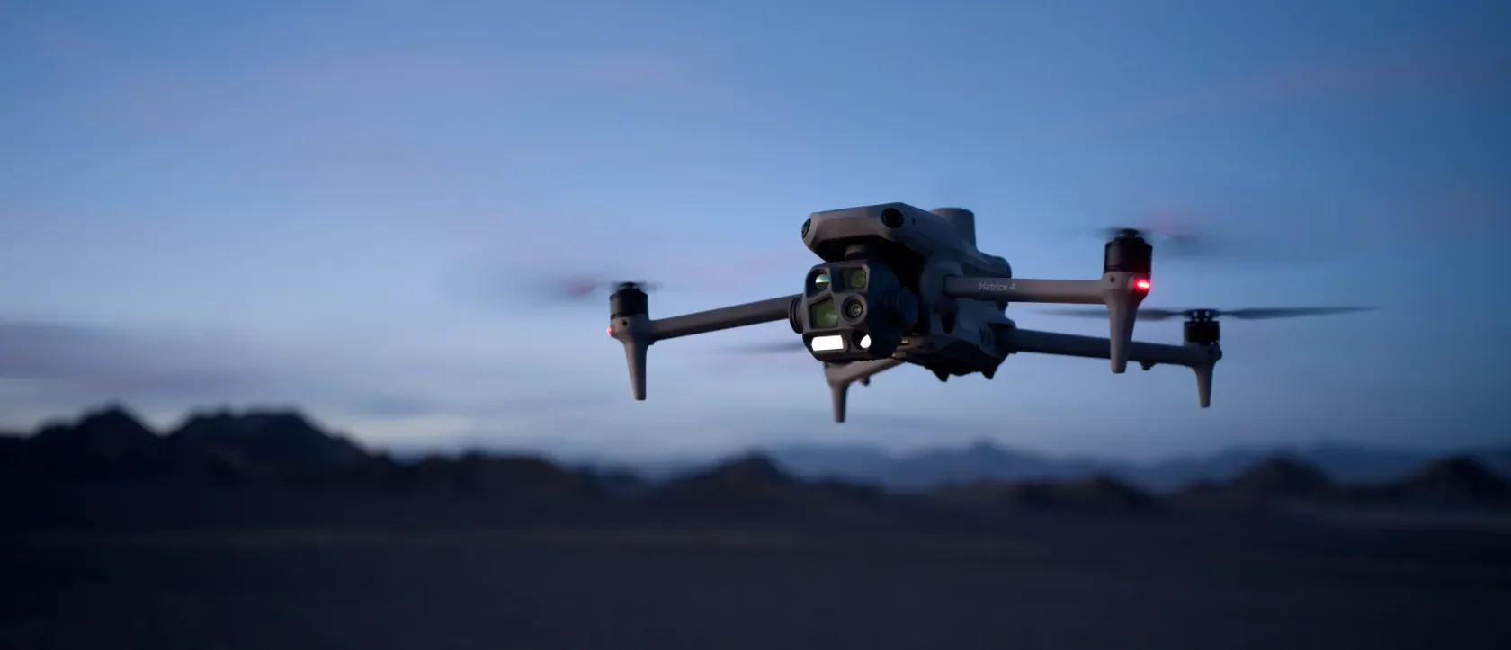 Image 7 of 8
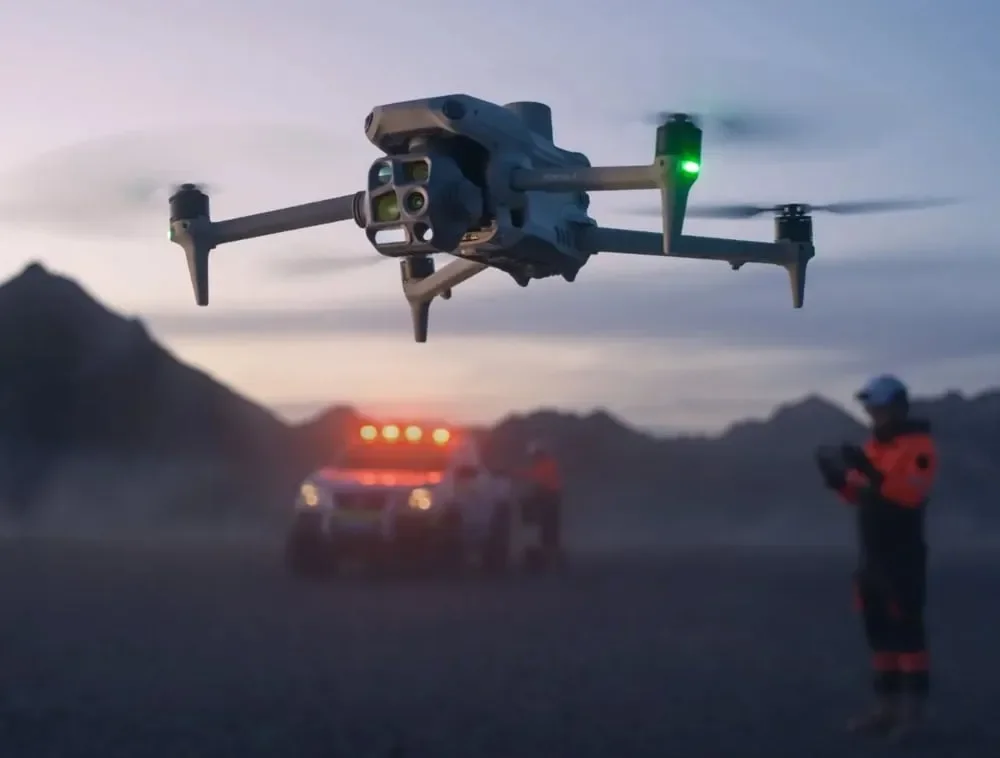 Image 8 of 8